GLOBE Data Spreadsheet AnalysisLab Members Treasure McMahan, Match Kay, Andrew Hayes |
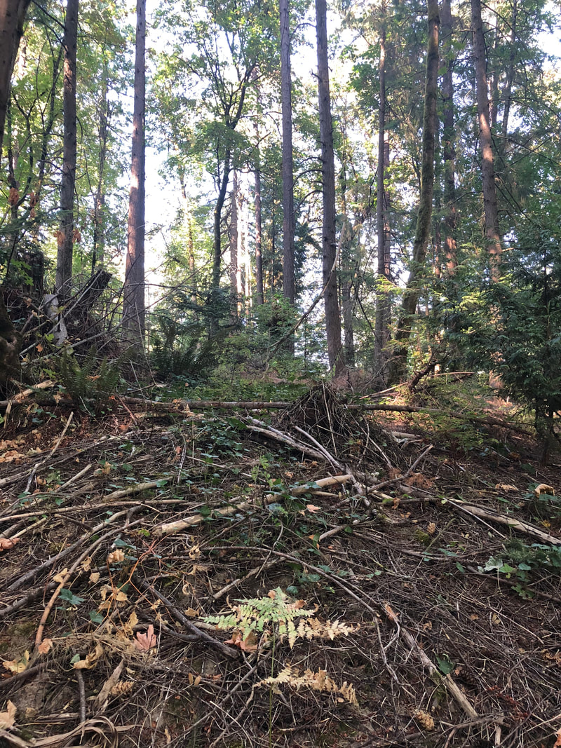 North 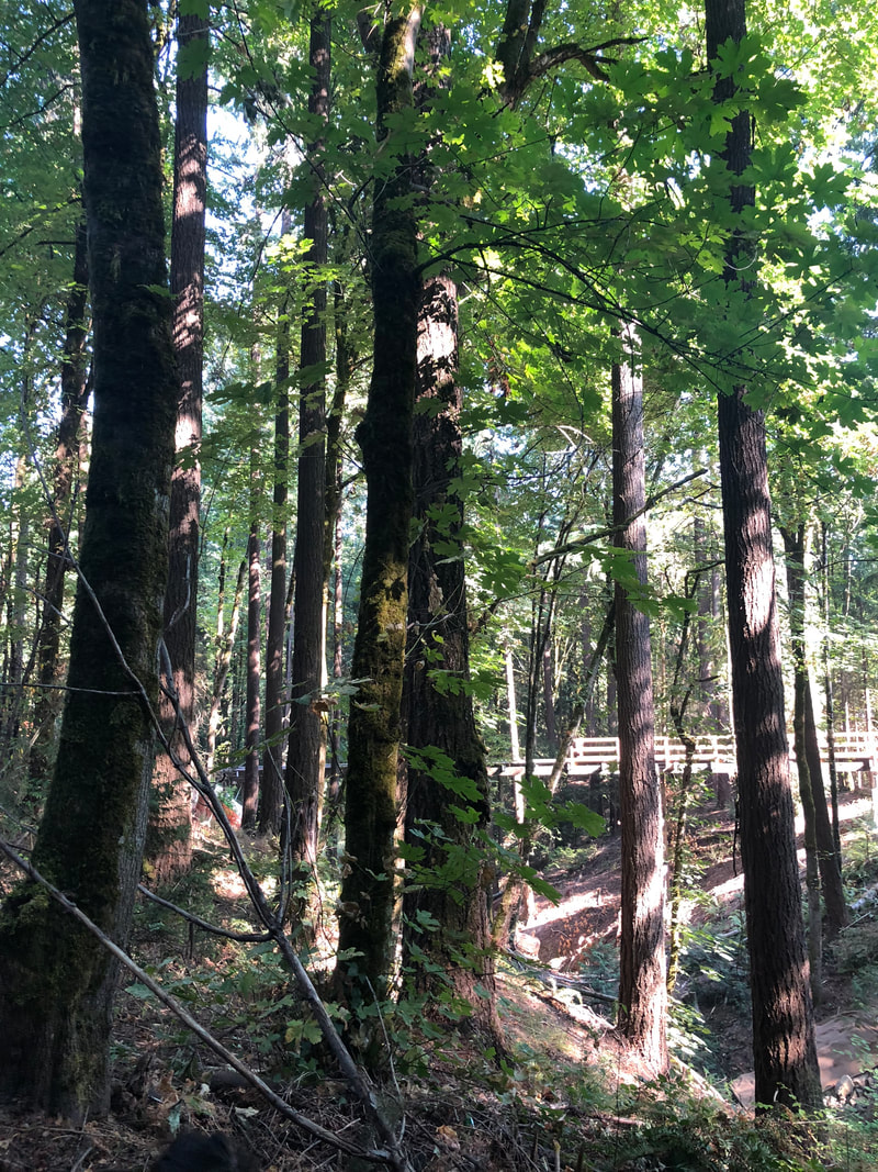 East | 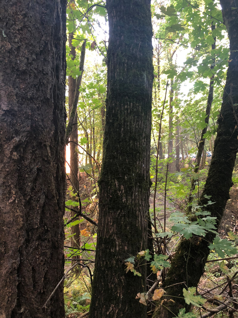 South 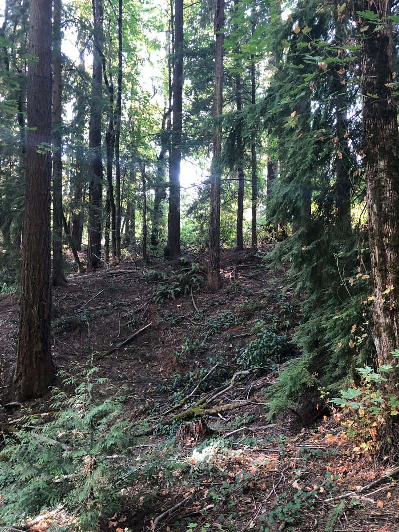 West |
The photos above show the landscape in each cardinal direction from the centroid.
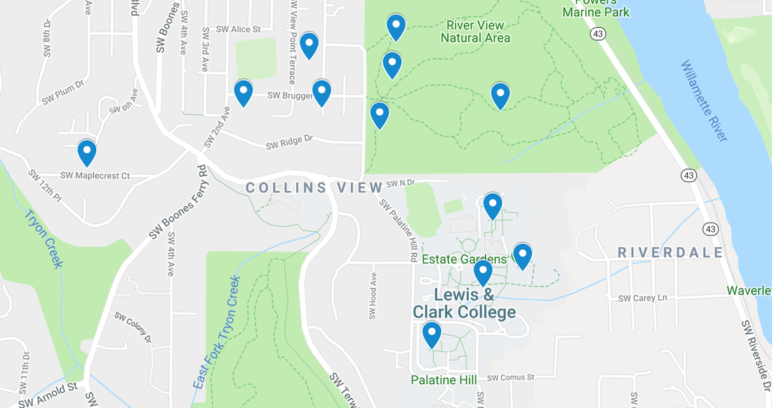
The pins on the map above show all 12 sites in the four general locations. The pins are placed at the coordinates of each sites' centroid.
Procedure/Analysis
We complied the crowdsourced data into a Google Sheet and merged the data from lab I and lab II, then added new temperature and humidity range fields. In a separate sheet, we prepared averaged data for the three general locations: Collins View, Riverview Natural Area (RVNA), and Lewis & Clark campus. Each general site has four data points, resulting in 12 unique sites in the vicinity of Lewis & Clark.
Next, we analyzed the microclimate and canopy/ground cover data for all of the sites by comparing the data values and creating charts (see results below).
Next, we analyzed the microclimate and canopy/ground cover data for all of the sites by comparing the data values and creating charts (see results below).
Results
Lewis & Clark Ravine in comparison to all other sites
The data we collected at our site, the Lewis & Clark Ravine, appears to be a combination of the data for the other Lewis & Clark sites and Riverview Natural Area. This makes logical sense, as our site is located on campus, but is similar to the natural landscape found in RVNA. There is similar canopy cover in the Ravine and RVNA. However, there is little English Ivy in the Lewis & Clark Ravine compared to RVNA. As mentioned in the discussion, Lewis & Clark has been working to remove English Ivy. While portions of RVNA on the other hand, are still overtaken by this invasive species. Because of this, our ground cover average is the opposite of the data collected in RVNA. The teams who collected data in RVNA noted that the Ivy was so abundant, practically every pace they took had ground cover.
Lewis and Clark Ravine in comparison to other Lewis & Clark sites
While our site shares a similar canopy cover average to RVNA, the tallest object in our site is similar to the tallest object found in the Lewis & Clark site closest to ours, with our tallest object measuring just 1 meter shorter. The temperature and humidity averages are also similar to the other Lewis & Clark campus sites, with one notable exception. Makayla and Maddy's site had an average temperature of 35.1 degrees celsius, while the other Lewis & Clark sites had average temperatures ranging from 19-19.9 degrees.
Our site had the most brown ground cover out of the four campus sites. This is likely due to the fact that the ravine landscape is outside of the Lewis & Clark maintenance domain.
Our site had the most brown ground cover out of the four campus sites. This is likely due to the fact that the ravine landscape is outside of the Lewis & Clark maintenance domain.
microclimate data for lewis & clark ravine
|
Microclimate data for other lewis & clark sites
|
Comparison of three general locations: Collins View, Riverview Natural Area, and Lewis & Clark
RVNA has a significantly higher ground cover average than the other locations, as well as the lowest temperature and highest humidity averages. This is most likely due to the thick canopy and ground cover, RVNA has the highest percent of canopy and ground cover of the three locations. The average tallest object measured in RVNA is also higher than all of the locations. We are inferring that this is because RVNA's tree cover appears similar to the tree cover seen in the 1939 aerial image (See Figure 2.1). The trees in RVNA are presumably much older than those found in Collins View Neighborhood, which were likely planted after the neighborhood's development. Additionally, the sites in Collins View were spatially limited, as they are located on personal property and constrained to individual's yards.
The Lewis & Clark sites vary greatly, with some sites located near dormitories where canopy cover is sparse, and others in more wooded areas such as the ravine. Because of this, the tallest object in the Lewis & Clark and Collins View sites is likely a building. Building height in these areas are generally two or three stories maximum, and feature few tall trees. Because the majority of samples were collected in developed areas, such as Lewis & Clark or Collins View, the tallest object is likely to be found in RVNA.
The Lewis & Clark sites vary greatly, with some sites located near dormitories where canopy cover is sparse, and others in more wooded areas such as the ravine. Because of this, the tallest object in the Lewis & Clark and Collins View sites is likely a building. Building height in these areas are generally two or three stories maximum, and feature few tall trees. Because the majority of samples were collected in developed areas, such as Lewis & Clark or Collins View, the tallest object is likely to be found in RVNA.
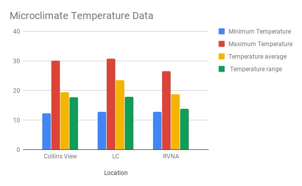 Figure 1.1 | 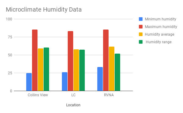 Figure 1.2 |
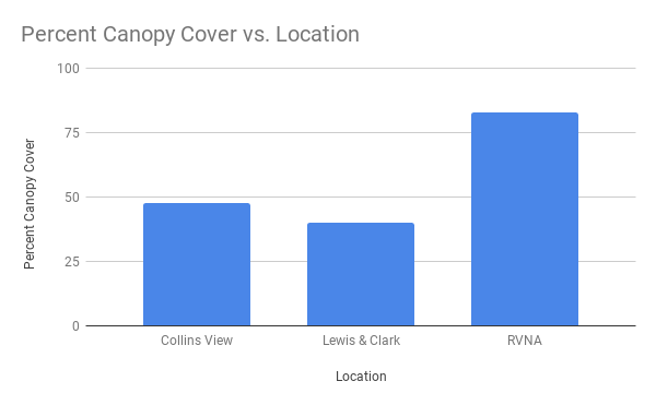 Figure 1.3 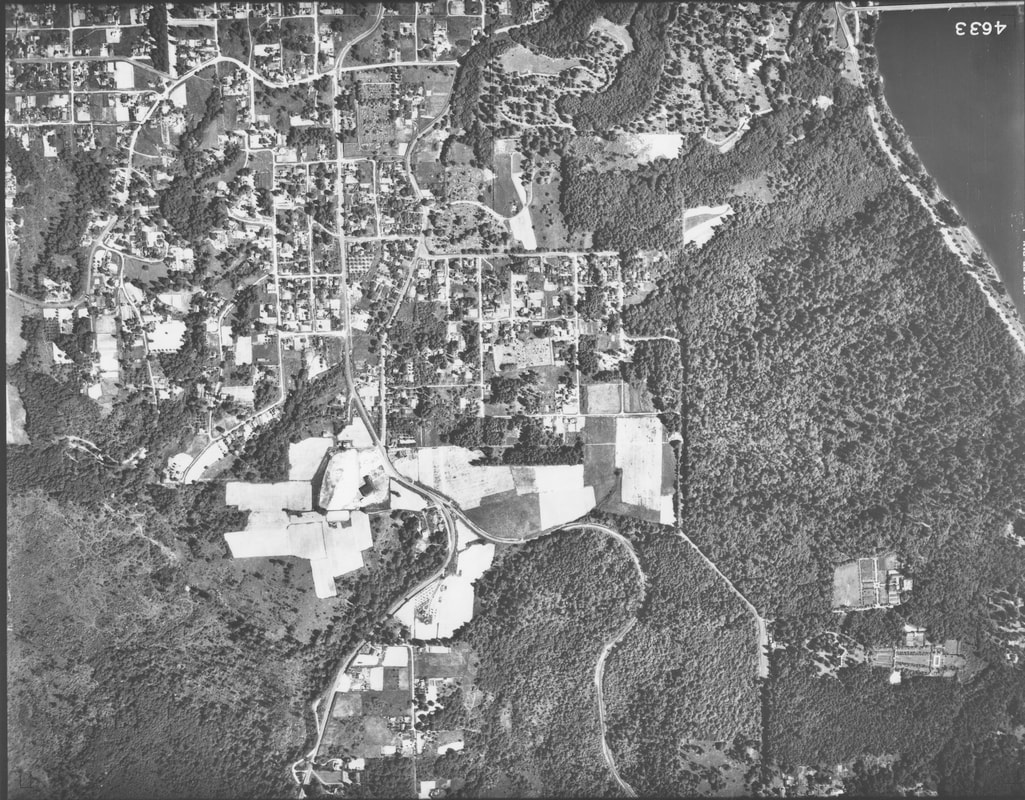 Figure 2.1 1939 Aerial View | 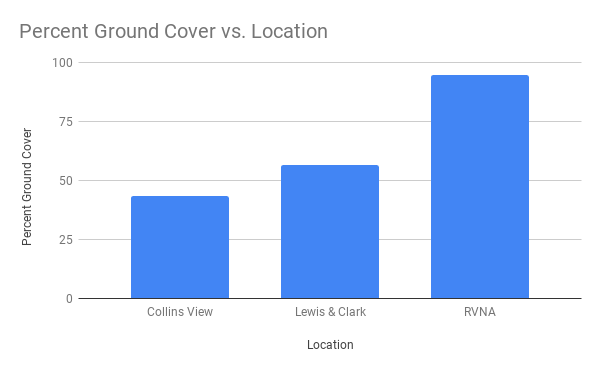 Figure 1.4 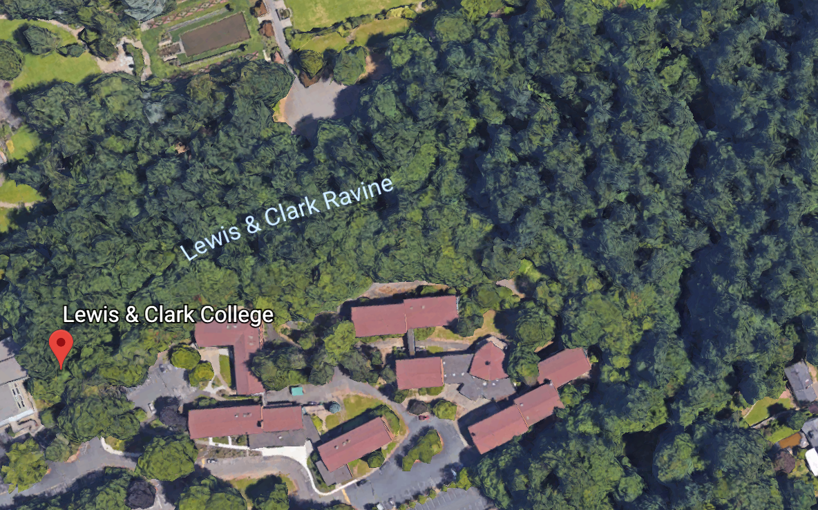 Figure 2.2 Current Google Image of Lewis & Clark Ravine |
Discussion
The data we collected at our site, the Lewis & Clark Ravine, is similar to the data collected in Riverview Natural Area and the other Lewis & Clark College sites. This is likely because the ravine is a combination of the landscapes found in RVNA and the more developed areas of Lewis & Clark campus. The microclimate data we collected at our site is similar to those collected at the other Lewis & Clark sites, except for one group whose average temperature was 16 degrees higher than the others. Our site had the highest number of brown ground cover of all sites, likely because the ravine landscape is not maintained as Collins View and developed areas of Lewis & Clark are.
At the centroid, our site is undeveloped and has dense canopy cover. However, the outer-perimeter of our 90 x 90m site features buildings, cleared walkways, and pavement. For this reason, the data we collected within our 30 x 30m pixel is not representative of the entire site. The area we surveyed has 90% canopy cover and 62.5% ground cover, which makes logical sense for a forested area. In order to achieve more accurate data for the entire site, we would need to survey the outer portion of the 90 x 90m square.
The small spacial-scale within our project presents another limitation. While samples collected in Collins View and Riverview Natural Area demonstrate clear-cut examples of residential versus forested landscapes, the data collected at Lewis & Clark represents a mixture of these two landscape types.
The timeline of our project, which has taken place over two weeks, is also limiting. As I mentioned in the background information, Lewis & Clark has removed English Ivy from the majority of campus boundaries. While our limited timeline allowed us to collect enough data to compare our site to the 1939 aerial photo, we are unable to measure how efforts to eradicate English Ivy have effected ground and canopy cover.
The use of a measuring tape to define our boundaries proved limiting as well. Because our site is heavily forested, it was difficult to accurately measure our 30 x 30m pixel. Additionally, we were unable to take GLOBE biometry measurements to the south of our centroid, due to the elevation change and dense nature of the forest.
The application of the Global Land Programme's protocol provided necessary framework for this project and allows us to better understand how our efforts reflect larger research efforts. However, the GLP protocol's generic nature limited our data collection. For example, English Ivy is an important factor when looking into land use/cover change in the Portland area, and the GLP framework did not allow us to include this element in an impactful way.
The land use cover change lab and application of Global Land Programme's framework provided information integral to the analysis of the Anthropocene's impact on the greater Lewis & Clark area.
0 Comments
Leave a Reply.
Treasure McMahan
I am an Environmental Studies and Sociology/Anthropology double major at Lewis & Clark College. This blog page is where I will post my lab write-ups for ENVS 220 "Environmental Analysis"
Archives
December 2018
November 2018
October 2018
September 2018
 RSS Feed
